Food nearby Café Sion
Coronavirus disease (COVID-19) Situation
confirmed cases
552695
deaths
5856
Venezuela
Food nearby Café Sion
Café Sion
Caracas 1090, Capital District, Venezuela
contacts phone
:
+58
Latitude:
10.4708447
, Longitude:
-66.8953788
larger map & directions
read more
nearest Food
16 m
Reposteria Caracas C.A
Caracas
Food
read more
455 m
Pa' la Parrilla
Caracas
Food
read more
849 m
Bodega renny
Caracas
Food
read more
1.409 km
Fabrica De Donas
Caracas
Food
read more
1.43 km
Bodega de Joel
Calle Matanza, Caracas
Food
read more
1.527 km
Abastos Parven
Edif. San Antonio, Calle Los Abogados, Caracas
Food
read more
1.846 km
GEOHIDRA
Calle Razetti, Caracas
Food
read more
2.012 km
Restaurant El Tropezón
Avenida La Facultad, Caracas
Food
read more
2.836 km
Mojitos Bodegón
1050, Caracas, Plaza Venezuela, Zona Rental , Centro comercial Bicentenario
Food
read more
3.075 km
Abasto De Rosa
Caracas
Food
read more
3.134 km
GOURMET KITCHEN C.A.
Av. Lecuna, Urb. Parque Central, Edif. Tajamar, Ofic.1. Local 114, Caracas
Food
read more
3.257 km
Agrícola La Milagrosa C.A.
Caracas
Food
read more
3.282 km
la chalana delpolo
1ra Calle, Caracas
Food
read more
3.382 km
Panaderia Pan Club
Caracas
Food
read more
3.424 km
Agricola Sabana Grande c.a.
Calle Las Flores, Caracas
Food
read more
3.485 km
El Semillero Nacional C.a.
Caracas
Food
read more
3.52 km
distribuidora jcad 29, c.a.
Tore Adosa, Calle Chacaíto, Caracas
Food
read more
3.535 km
VH Express
45 Calle Los Apamates, Caracas
Food
read more
4.122 km
KAKAO
Trasnocho Cultural. Centro Comercial Paseo, Las Mercedes, Caracas
Food
read more
4.279 km
Prolicor
Avenida Veracruz, Caracas
Food
read more
4.459 km
Supermercado Fatima
Calle Colegio Americano, Caracas
Food
read more
4.616 km
Dulceria Daviley
Caracas
Food
read more
4.65 km
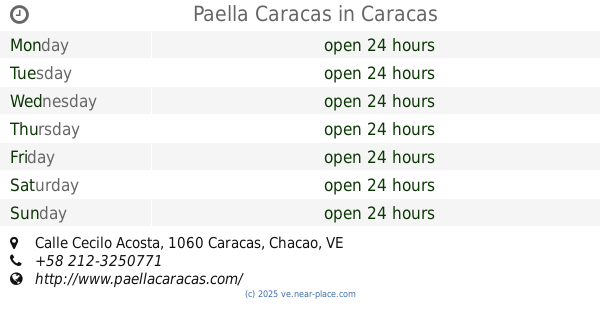
Paella Caracas
Calle Cecilo Acosta, Caracas
Food
read more
4.916 km
Fresh Fish Delivery
Caracas
Food
read more
5.225 km
Distribuidora Casa de Campo
Calle Páez, Chacao, Caracas Venezuela, Caracas
Food
read more
📑
all categories
Accounting
Administrative area level 1
Administrative area level 2
Airport
Amusement park
Aquarium
Art gallery
Atm
Bakery
Bank
Bar
Beauty salon
Bicycle store
Book store
Bowling alley
Bus station
Cafe
Campground
Car dealer
Car rental
Car repair
Car wash
Casino
Cemetery
Church
City hall
Clothing store
Colloquial area
Convenience store
Courthouse
Dentist
Department store
Doctor
Electrician
Electronics store
Embassy
Finance
Fire station
Florist
Food
Funeral home
Furniture store
Gas station
General contractor
Grocery or supermarket
Gym
Hair care
Hardware store
Health
Hindu Temple
Home goods store
Hospital
Insurance agency
Jewelry store
Laundry
Lawyer
Library
Light rail station
Liquor store
Local government office
Locality
Locksmith
Lodging
Meal delivery
Meal takeaway
Mosque
Movie rental
Movie theater
Moving company
Museum
Natural feature
Neighborhood
Night club
Painter
Park
Parking
Pet store
Pharmacy
Physiotherapist
Place of worship
Plumber
Point of interest
Police
Post office
Premise
Real estate agency
Restaurant
Roofing contractor
Route
Rv park, camping
School
Shoe store
Shopping mall
Spa
Stadium
Storage
Store
Subpremise
Subway station
Supermarket
Synagogue
Taxi stand
Train station
Transit station
Travel agency
University
Veterinary care
Zoo
administrative area level 3
sublocality level 1
↑