Gas station nearby E/S CCM Digecom
Venezuela
Gas station nearby E/S CCM Digecom
E/S CCM Digecom
Avenida Alirio Ugarte Pelayo, Maturín Venezuela, República Bolivariana de
contacts phone
:
+58
Latitude:
9.7607736
, Longitude:
-63.1865841
read more
nearest Gas station
319 m
E/S CCM Vespa
Avenida Alirio Ugarte Pelayo, Maturín
Gas station
read more
2.165 km
E/S PDV Avenida Juncal
Maturin
Gas station
read more
2.584 km
Service Station El Manantial
Maturin
Gas station
read more
2.584 km
Estación De Servicio El Manantial
Maturín
Gas station
read more
2.666 km
Taller de Tripoides Taroca
Maturin
Gas station
read more
2.901 km
E/S Bolivar
Avenida Bolivar, Maturín
Gas station
read more
2.994 km
E/S González
Maturin
Gas station
read more
3.255 km
E/S PDV Libertador
Avenida Alberto Carnevalli, Maturín
Gas station
read more
3.556 km
PLAZA DE LA GUARIMBA
Maturin
Gas station
read more
3.573 km
E/S Libertador
Avenida Libertador, Maturín
Gas station
read more
3.729 km
E/S CCM Escorpión
Maturin
Gas station
read more
3.754 km
E/S Escorpion
Maturin
Gas station
read more
3.931 km
Rojas Service Station
Maturin
Gas station
read more
3.931 km
Estación de Servicios Rojas
Maturín
Gas station
read more
4.121 km
E/S Orinoco II
Maturin
Gas station
read more
4.936 km
Energy Lider
Galpón Energy Líder, Sector Paramaconi, Estado, Avenida Bella Vista, Maturín
Gas station
read more
4.994 km
E/S PDV Bella Vista
Avenida Bella Vista, Maturín
Gas station
read more
5.082 km
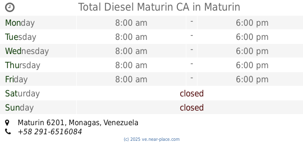
Total Diesel Maturin CA
Maturin
Gas station
read more
5.154 km
E/S PDV
Avenida Bella Vista, Maturín
Gas station
read more
5.744 km
E/S El Parque
Maturin
Gas station
read more
6.251 km
E/S Alcabala de Maturin
Maturín
Gas station
read more
6.27 km
Taller Mecanico "El Gocho"
Maturin
Gas station
read more
7.306 km
E/S Alex
Avenida Bella Vista, Maturín
Gas station
read more
10.408 km
PDVSA Planta Distribucion Maturin
zon ind., Maturín
Gas station
read more
13.87 km
E/S PDV San Vicente
Avenida Bella Vista, San Vicente
Gas station
read more
📑
all categories
Accounting
Administrative area level 1
Administrative area level 2
Airport
Amusement park
Aquarium
Art gallery
Atm
Bakery
Bank
Bar
Beauty salon
Bicycle store
Book store
Bowling alley
Bus station
Cafe
Campground
Car dealer
Car rental
Car repair
Car wash
Casino
Cemetery
Church
City hall
Clothing store
Colloquial area
Convenience store
Courthouse
Dentist
Department store
Doctor
Electrician
Electronics store
Embassy
Finance
Fire station
Florist
Food
Funeral home
Furniture store
Gas station
General contractor
Grocery or supermarket
Gym
Hair care
Hardware store
Health
Hindu Temple
Home goods store
Hospital
Insurance agency
Jewelry store
Laundry
Lawyer
Library
Light rail station
Liquor store
Local government office
Locality
Locksmith
Lodging
Meal delivery
Meal takeaway
Mosque
Movie rental
Movie theater
Moving company
Museum
Natural feature
Neighborhood
Night club
Painter
Park
Parking
Pet store
Pharmacy
Physiotherapist
Place of worship
Plumber
Point of interest
Police
Post office
Premise
Real estate agency
Restaurant
Roofing contractor
Route
Rv park, camping
School
Shoe store
Shopping mall
Spa
Stadium
Storage
Store
Subpremise
Subway station
Supermarket
Synagogue
Taxi stand
Train station
Transit station
Travel agency
University
Veterinary care
Zoo
administrative area level 3
sublocality level 1
↑