places in Mariara
Venezuela
Mariara
Mariara
Administrative Region:
Carabobo
population:
115 515
calling code:
+58-243
postcode:
2017
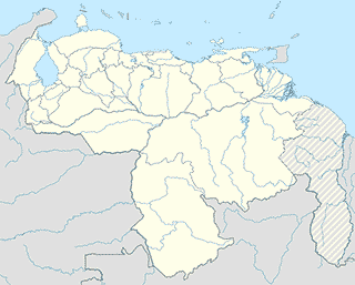
Location on the map of Venezuela
Mariara
Night club
Club Chaparral
Mariara
Night club
read more
Place of worship
Iglesia Maranatha Mariara
Mariara
Place of worship
read more
Iglesia Evangelica De La PetroCasa
Mariara
Place of worship
read more
Point of interest
Escaleras Aladinos, C.A.
81, Calle Las Americas, Ciudad Guayana
Point of interest
read more
C.I.C.P.C. Delegacion Mariara
Mariara
Point of interest
read more
Club La Frontera
Calle Mexíco, Aguas Calientes
Point of interest
read more
Destacamento Guardia Nacional Bolivariana
Mariara
Point of interest
read more
Subestación Santa Clara
San Joaquín
Point of interest
read more
Procominca, C.A., Grupo Conaca
Mariara
Point of interest
read more
TuboFlex C.A
Mariara
Point of interest
read more
Ciudadela José Antonio Anzoátegui
Mariara
Point of interest
read more
ACEROS LARA C.A
Calle Mérida, Vista Alegre
Point of interest
read more
CADAFE
Mariara
Point of interest
read more
VENCOR
Ctra. Nacional, Mariara
Point of interest
read more
Centro de atencion y operaciones Logisticas SomosVER
Calle La Estacion, Mariara
Point of interest
read more
Parque Industrial Carmelo Lauricella - Corporación CLC
Mariara
Point of interest
read more
MASISA MARIARA
Prolongación Calle Diego de Tovar, Zona Industrial Covenal, Galpon 22-A y 23-G, Mariara. Edo. Carabobo
Point of interest
read more
Inversiones Venescalum, C.A.
Local 53 Calle Las Americas c/c Colombia, Sector Aguas Calientesas Calientes
Point of interest
read more
Atm
Cajeros Automáticos Banco De Venezuela
Mariara
Atm
read more
Bakery
Panaderia Andina
Mariara
Bakery
read more
La Halina
Avenida Libertador, Aguas Calientes
Bakery
read more
Panaderia Bripan
Carretera Nacional, Aguas Calientes
Bakery
read more
Panadería Caribe
Carretera Nacional, Mariara
Bakery
read more
The H&H Bakery, C.A.
Mariara
Bakery
read more
📑
Mariara all categories
Administrative area level 2
Atm
Bakery
Bank
Bar
Beauty salon
Book store
Bus station
Cafe
Campground
Car repair
Cemetery
Church
City hall
Clothing store
Dentist
Electrician
Electronics store
Florist
Funeral home
Furniture store
Gas station
Grocery or supermarket
Gym
Hair care
Hardware store
Health
Home goods store
Hospital
Library
Liquor store
Local government office
Locality
Lodging
Moving company
Natural feature
Neighborhood
Night club
Park
Pharmacy
Place of worship
Point of interest
Police
Premise
Restaurant
Route
School
Shopping mall
Stadium
Store
Supermarket
Taxi stand
Train station
University
administrative area level 3
sublocality level 1
↑