places in Ocumare del Tuy
Venezuela
Ocumare del Tuy
Ocumare del Tuy
Administrative Region:
Miranda
population:
150 000
calling code:
+58-239
postcode:
1209
Location on the map of Venezuela
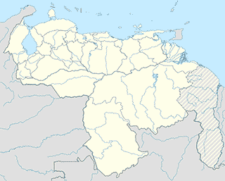
Ocumare del Tuy
Gym
Gimnasio Hermanos Vargas
Ocumare del Tuy
Gym
read more
Canchas de Basket
Calle Machillanda, Ocumare del Tuy
Gym
read more
Estadio El Cerrito
El Cerrito,, Ocumare del Tuy
Gym
read more
Cancha de Baloncesto
Ocumare del Tuy
Gym
read more
Infinitos GYM
Calle Carabobo, Ocumare del Tuy
Gym
read more
Health
IBYDI, C.A. (Instituto Biológico y de Irradiación, C.A.)
Carretera Nacional Ocumare del Tuy-Cua, Urbanización Pueblo Real, Municipio Tomas Lander, Parroquia Santa Barbara, Estado Z.P. 1209, Venezuela.
Health
read more
Residencia Las Nenas.
Final de la, Avenida Ribas, Ocumare del Tuy
Health
read more
Natural feature
Río Tuy
Chaparral
Natural feature
read more
Rio Tuy
Ocumarito
Natural feature
read more
Topo El Tigrito
Ocumare del Tuy
Natural feature
read more
Rio Tuy
Ocumare del Tuy
Natural feature
read more
Topo Los Monos
Venezuela, República Bolivariana de
Natural feature
read more
Embalse Ocumarito
Ocumare del Tuy
Natural feature
read more
Cerro Las Bonitas
Venezuela, República Bolivariana de
Natural feature
read more
Topo San Miguel
Ocumare del Tuy
Natural feature
read more
Fila Las Yaguas
Ocumare del Tuy
Natural feature
read more
Cerro Penas Negras
Ocumare del Tuy
Natural feature
read more
Fila de Mararito
Ocumare del Tuy
Natural feature
read more
Cerro La Soledad
Ocumare del Tuy
Natural feature
read more
Neighborhood
Sector Las Dos Rosas
El Calvario
Neighborhood
read more
Los Cajones
Ocumare del Tuy
Neighborhood
read more
Stadium
Estadio Efrain Rodriguez
Cristobal Rojas
Stadium
read more
Stadium Corocito
Ocumare del Tuy
Stadium
read more
Estadio Bomberos/Casa Blanca
Ocumare del Tuy
Stadium
read more
Estadio de Corocito
Ocumare del Tuy
Stadium
read more
📑
Ocumare del Tuy all categories
Administrative area level 2
Airport
Amusement park
Bakery
Bank
Bar
Book store
Bus station
Cafe
Car dealer
Car repair
Cemetery
Church
Clothing store
Courthouse
Doctor
Fire station
Food
Funeral home
Gas station
Grocery or supermarket
Gym
Hair care
Hardware store
Health
Home goods store
Hospital
Liquor store
Local government office
Locality
Locksmith
Lodging
Natural feature
Neighborhood
Night club
Park
Parking
Pharmacy
Place of worship
Point of interest
Premise
Restaurant
Route
School
Shopping mall
Stadium
Store
Supermarket
University
administrative area level 3
sublocality level 1
↑