Park nearby Parque La Romerita
Venezuela
Park nearby Parque La Romerita
Parque La Romerita
San Cristobal Venezuela, Bolivarian Republic of
contacts phone
:
+58
Latitude:
7.7753012
, Longitude:
-72.2169472
read more
nearest Park
152 m
Entrada del Parque la Romerita
San Cristobal
Park
read more
357 m
Parque la Parada
San Cristóbal
Park
read more
357 m
la Parada Park
San Cristobal
Park
read more
405 m
Peace Square
San Cristobal
Park
read more
405 m
Plaza De La Paz
San Cristóbal
Park
read more
540 m
Parque de los Escritores Tachirenses
Avenida Juan de Maldonado, San Cristóbal
Park
read more
540 m
Escritores Tachirenses Park
Avenida Juan de Maldonado, San Cristóbal
Park
read more
555 m
Parque de los Escritores Tachirenses
Pirineos Parte Alta
Park
read more
571 m
Plaza De Los Mangos
Barrio Obrero, San Cristóbal 5001
Park
read more
572 m
Plaza Del Carmen Ramirez Briceño María
San Cristobal
Park
read more
572 m
Plaza María Del Carmen Ramírez Briceño
San Cristóbal
Park
read more
851 m
Parque
San Cristóbal 5001
Park
read more
1.37 km
Plaza de La Libertad
La Guacara
Park
read more
1.38 km
Plaza Garbiras
La Guacara
Park
read more
1.572 km
Redoma Aurinrgra
San Cristobal
Park
read more
1.573 km
Parque Murachi
Urbanización Mérida
Park
read more
1.692 km
Parque Monseñor Alejandro Fernández Feo
Avenida 19 de Abril, San Cristóbal
Park
read more
1.692 km
Parque Metropolitano
Avenida 19 de Abril, San Cristóbal
Park
read more
1.722 km
Bosque Natural Ucat
San Cristobal
Park
read more
1.785 km
La Fontana
Urb. La Fontana, San Cristóbal
Park
read more
1.805 km
Parque el Calvario
Calle 15, San Cristóbal
Park
read more
1.862 km
Plaza Antonio Jose De Sucre
San Cristóbal
Park
read more
1.963 km
Redoma Educator
San Cristobal
Park
read more
1.963 km
Redoma Del Educador
San Cristóbal
Park
read more
2.139 km
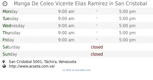
Manga De Coleo Vicente Elias Ramirez
San Cristobal
Park
read more
📑
all categories
Accounting
Administrative area level 1
Administrative area level 2
Airport
Amusement park
Aquarium
Art gallery
Atm
Bakery
Bank
Bar
Beauty salon
Bicycle store
Book store
Bowling alley
Bus station
Cafe
Campground
Car dealer
Car rental
Car repair
Car wash
Casino
Cemetery
Church
City hall
Clothing store
Colloquial area
Convenience store
Courthouse
Dentist
Department store
Doctor
Electrician
Electronics store
Embassy
Finance
Fire station
Florist
Food
Funeral home
Furniture store
Gas station
General contractor
Grocery or supermarket
Gym
Hair care
Hardware store
Health
Hindu Temple
Home goods store
Hospital
Insurance agency
Jewelry store
Laundry
Lawyer
Library
Light rail station
Liquor store
Local government office
Locality
Locksmith
Lodging
Meal delivery
Meal takeaway
Mosque
Movie rental
Movie theater
Moving company
Museum
Natural feature
Neighborhood
Night club
Painter
Park
Parking
Pet store
Pharmacy
Physiotherapist
Place of worship
Plumber
Point of interest
Police
Post office
Premise
Real estate agency
Restaurant
Roofing contractor
Route
Rv park, camping
School
Shoe store
Shopping mall
Spa
Stadium
Storage
Store
Subpremise
Subway station
Supermarket
Synagogue
Taxi stand
Train station
Transit station
Travel agency
University
Veterinary care
Zoo
administrative area level 3
sublocality level 1
↑